
The Rogue River in southwest Oregon starts as a spring bursting from the slopes of the Cascade Mountains west of Crater Lake before flowing 215 miles to the Pacific Ocean.
At 5,300 feet, the headwaters of the Rogue flow from a spring on the west side of Crater Lake. Boundary Springs, the source of the Rogue River, emerges from the volcanic hillside as a burbling stream beginning its journey toward the Pacific Ocean.

The source of the Rogue River at Boundary Springs.
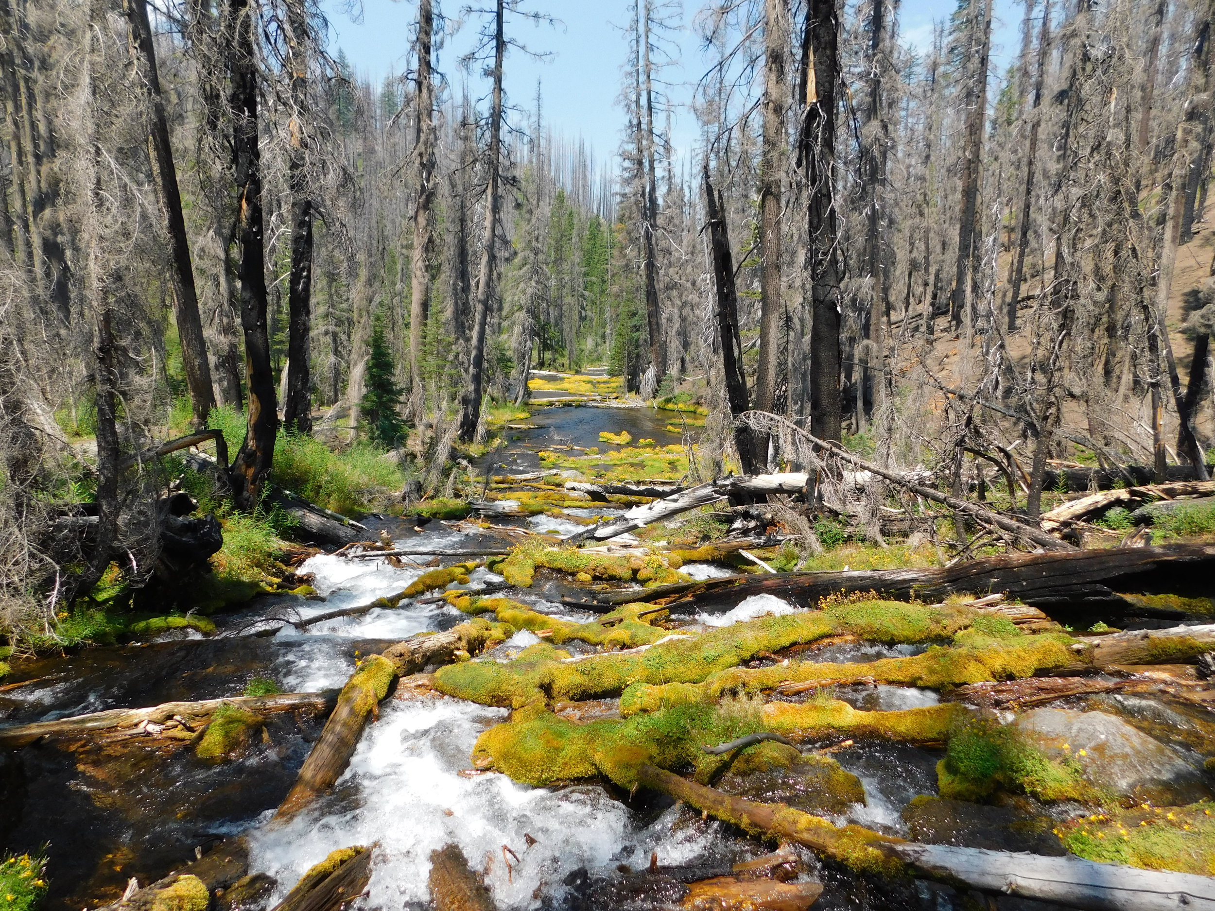
The Rogue River as it cascades down from its source at Boundary Springs.
From its headwaters at Boundary Springs, the Rogue tumbles through the volcanic legacy of the western slopes of the High Cascades and through the older Western Cascades near the town of Prospect, Oregon. Approximately 40 miles of the Upper Rogue are designated as a Wild & Scenic River from the boundary of Crater Lake National Park to the boundary of the Rogue River National Forest.


William Jess Dam at Lost Creek Lake, Wikipedia Commons
Downstream from where the South Fork of the Rogue flows into the main stem of the Rogue, the river begins to cut through the Klamath Mountains. The William L. Jess Dam, constructed in 1977 primarily for flood control, forms the Lost Creek Lake Reservoir.
As the Rogue winds its way through the Klamath Mountains, several large tributaries flow into the river. Bear Creek joins the Rogue just upstream from the city of Gold Hill and is the most urbanized area of the watershed. Bear Creek flows through the towns of Ashland, Talent, Phoenix, Medford, and Central Point. Approximately half of the 3.3 million-acre watershed’s population lives along Bear Creek.
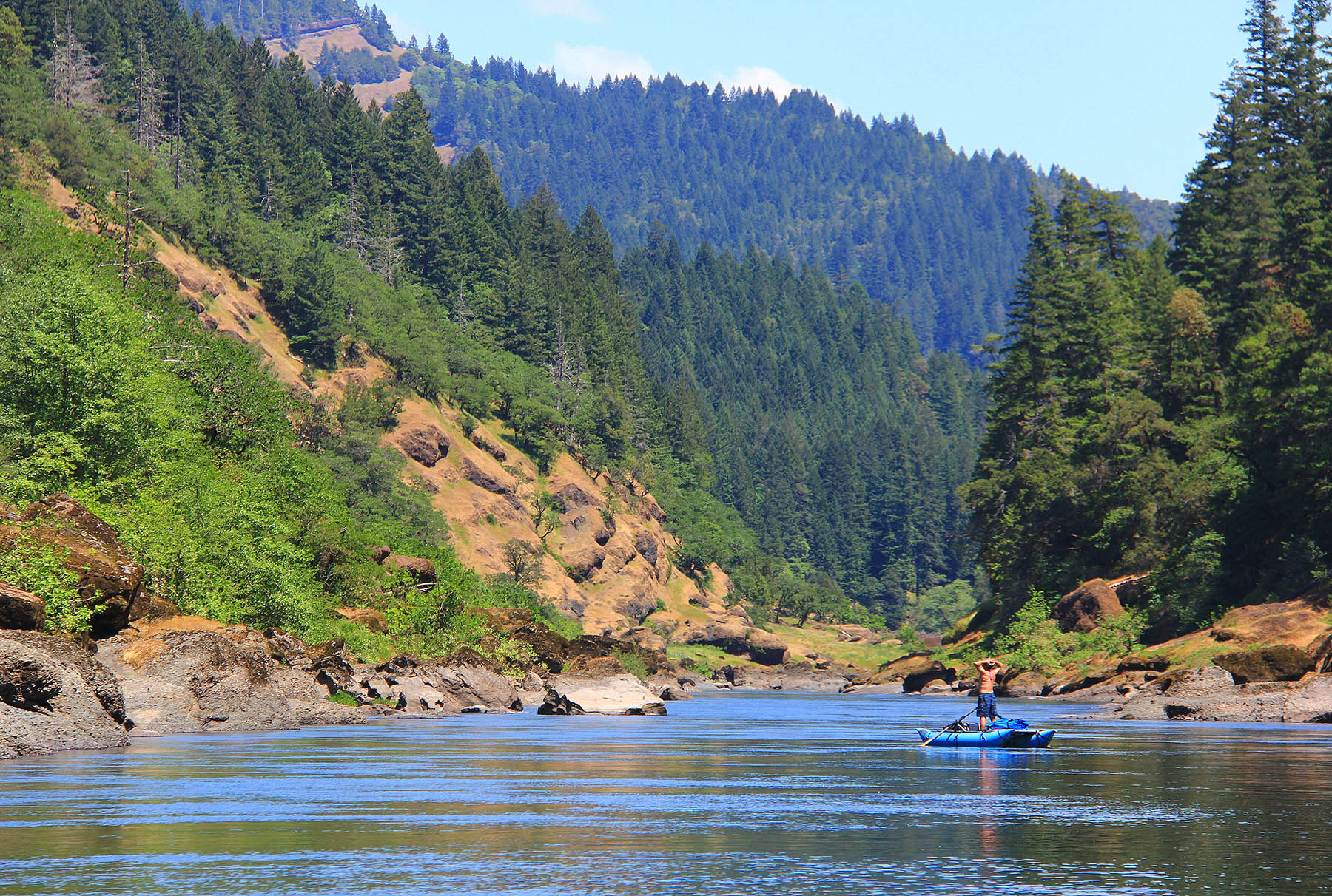
As the Rogue leaves the valley plateau near Grants Pass, Oregon, the river cuts a deep canyon through the geologically complex and remote Klamath-Siskiyou Mountains. Downstream from the city of Grants Pass, the Applegate River flows into the Rogue and so begins the Wild & Scenic section of the Rogue.
In 1968, Congress enacted the Wild and Scenic Rivers Act, protecting eight rivers throughout the US for their outstanding Wild, Scenic, and/or Recreational values. The Rogue was one of the original eight rivers. From the mouth of the Applegate to the Lobster Creek Bridge 84.5 miles downstream, the Rogue is protected under this law. Near the town of Agness, Oregon, the Wild and Scenic Illinois River joins the Rogue. From the boundary of the Siskiyou National Forest downstream to its confluence with the Rogue, 50.4 miles of the Illinois are also designated as a Wild & Scenic River.
After its winding journey through the Klamath-Siskiyou Mountains, the Rogue finally flows into the Pacific Ocean near the town of Gold Beach, Oregon, 215 miles from its source.

Fall in love with the Rogue in this cinematic experience:
Rogue River Fast Facts
Length of the River: 215 miles from source to sea (151 miles free flowing from Lost Creek Lake to the Pacific Ocean)
Size of Basin: 3.3 million acres, 5100 square miles
Wild & Scenic River: 41 miles from Boundary Springs to Lost Creek Lake (designated in 1986) and 84.5 miles from the Applegate to the Lobster Creek Bridge (designated in 1968).
Population: Approx. 257,914
Largest Tributary: The Illinois River. 56 miles long, 50 miles are Wild & Scenic
Source: Boundary Springs
Mouth: Gold Beach, Oregon
Fish Species: Coho Salmon, Chinook Salmon, Steelhead, Green Sturgeon, Pacific Lamprey